Project Overview:
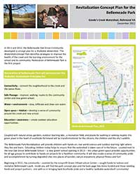
From 2009 to 2010 the GIC created a green infrastructure assessment of the entire City of Richmond, VA. This built upon work conducted by the Richmond Regional Planning District, with help from GIC, to create a green assets map for the city. The GIC and its partners at E2Inc. then mapped opportunities to re-green the city. The team identified areas that can be re-greened and reconnected to provide habitat for people and wildlife, walkability and stormwater infiltration to create a cleaner James River. The GIC then picked an example watershed – Upper Goode’s Creek – to demonstrate how to use the GI assessment to identify restoration opportunities though concerted community engagement. The GIC followed up with demonstration projects, such as creating a new park and walkability access to school and also an arboretum, which are detailed below with links to plans and reports.
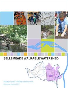
The GIC selected the Upper Goode’s Creek Watershed as the demonstration watershed for the plan as it has natural assets, but suffers from excessive imperviousness, lack of access to outdoor amenities and also has areas needing cleanup and restoration. The project identified opportunities to infiltrate and clean rainwater, while providing neighborhood amenities such as trails, trees and park enhancements.
Goode’s Creek Park, Safe Route to School and the Watershed Coalition
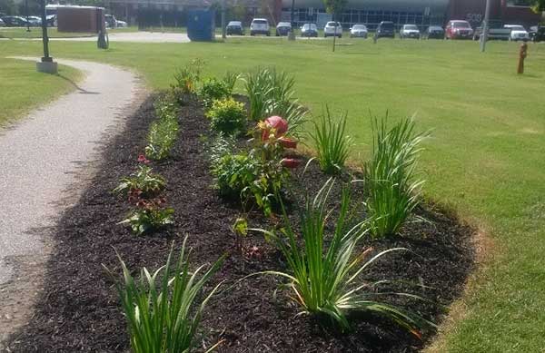
In 2011, the GIC planned several projects in the lower watershed. The project sites were identified as part of the GIC’s vacant lands to regreen in the GIC’s Richmond Green Infrastructure Assessment. In the fall of 2012, the GIC and its partners installed a small 2-acre park and restoration projects adjacent to the planned Bellemeade Oak Grove School. The GIC formed a coalition of partners to show how partnerships create expanded capacity for restoration. In the spring of 2013, GIC, the James River Association (JRA), and the Alliance for the Chesapeake Bay (the Alliance) partnered with the City of Richmond to restore the stream banks, install a forested buffer and create a bioswale (a linear garden that filters polluted runoff) to detain and clean neighborhood stormwater before it reaches the creek. These actions reduce pollutant loads into the creek while also providing outdoor recreation and learning opportunities for the community and the new Bellemeade Oak Grove School.
installed by the James River Association.
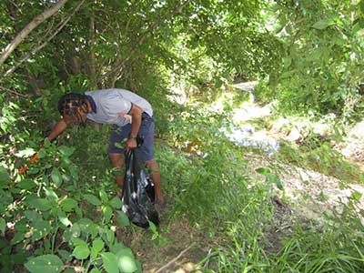
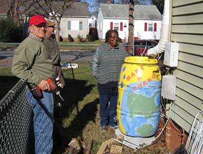
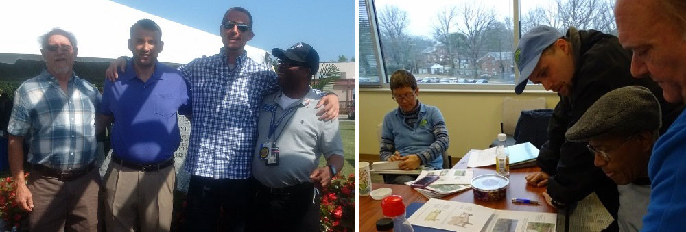
A Watershed Coalition was formed by the GIC to enlist more community participation in the project and they created strategies to clean up neighborhoods and held a Revitalize the Southside Festival in October 2013. The JRA and the Alliance also led trash clean-ups, installed watershed storm drain makers and rainbarrels and worked with residents to enroll them in yard by yard habitat and stormwater abatement projects.
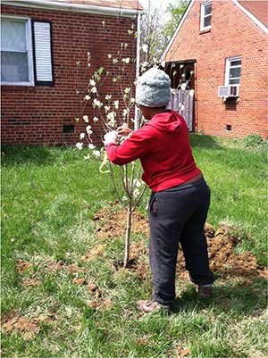
The GIC planted 44 native riparian trees and dozens of shrubs to build the stream buffer along Goodes Creek to revitalize the park, as well as trails and also trees in yards, along a safe route to school to encourage children to exercise by walking to school! Exposure to nature for just 20 minutes a day dramatically improves cognitive abilities and thus helps children learn. Several hundred more saplings were also planted by The Alliance for the Chesapeake Bay. The stream buffer planting and safe routes to school were funded by the Virginia Department of Forestry, the Chesapeake Bay Program and Altria Group. A bridge has also been installed (as called for in the park plan created by the Coalition) to allow kids to cross the creek and walk to school. The Watershed Coalition was managed by a local resident hired by the GIC and included community volunteers from Trinity United Methodist Church and the Oak Grove, Bellemeade and Jefferson Davis Civic Associations, the Oak Grove Bellemeade School, Gene’s Supermarket, JRA and The Alliance.
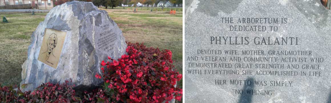
Phyllis E. Galanti Memorial Arboretum at McGuire Veterans Hospital
In 2014, the GIC launched a project to plant trees at the McGuire Veterans Hospital to create a healthier environment for patients, visitors and staff. The site was chosen based on GIC’s Goode’s Creek watershed analysis, which showed that this area needed restoration. The 123 acre hospital site has excessive impervious areas and needs to meet its stormwater management goals for reducing runoff.
Funded by the Altria Group in year one, the GIC designed the demonstration project to show how large open spaces can be reclaimed as natural areas and also used to infiltrate water. Patients heal up to 30 percent faster when they can see or access green spaces, so selecting this site for an arboretum also provided a direct benefit to the hospital’s mission. The arboretum is located just behind the Fisher House (an away home for family members who have veterans under hospital care) and barracks where disabled veterans are housed during recuperation.
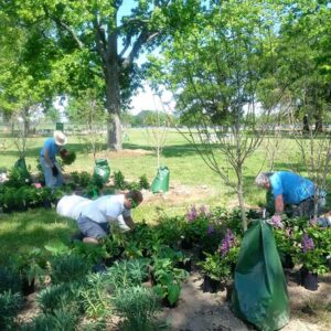
The GIC planted 44 trees on a geothermal wellfield site. The first participant, ‘Ron’, volunteered to work with GIC staff at the site and he inspired hospital administrator John A. Brandecker to take a personal interest in the trees. He bought Mr. Brandecker out to see his ‘babies’ – all the trees he had helped plant – and asked the hospital to help care for the site and place an American flag there. A request was then sent to the U.S. Congress asking that the site be declared an arboretum named after Phyllis E. Galanti, who started the POW MIA program after her husband Paul Galanti became the longest serving POW in the history of the U.S.
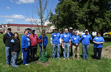
Based on the success working with Ron, the GIC partnered with the hospital’s work force re-entry and counseling program to create a green jobs training program for disabled veterans (see photos of class and field trainings). In 2015, the Dominion Foundation, the Virginia Department of Forestry and the Alliance for the Chesapeake Bay provided the GIC with a grant to plant more trees and hire disabled veterans to become the project’s ‘urban foresters.’ The goal was to help both people and nature heal and to help veterans regain their place in the civilian workforce, following their struggles with homelessness, addiction and Post Traumatic Stress Disorder, as well as physical disabilities suffered in wartime. The GIC hired a social worker, Teri Frazier, and an urban forester, Lara Johnson, to manage the project.
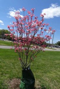
More trees were then planted, bringing the total to more than 90, all 1-2 inch caliper trees of about 6-8 feet in height. Dominion Power, which has a hands-on philanthropy ethic, even created a volunteer day to help install our plantings in the spring of 2016.
The GIC hired eight veterans as apprentices who graduated from the program into full-time jobs. For example, Ron’s life changed tremendously thanks to the care from the VA Hospital and GIC. Having been blown up by an IED, suffering from PTSD and being homeless, he now has a full-time job and his own apartment, and even his health is continuing to improve following a number of surgeries. Ron joined us at the dedication of the arboretum with the other veterans.
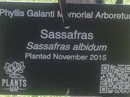
Leading up to the dedication, more work was done as excitement about the site grew. The GIC helped the hospital create a website about the trees and created smart tags and fact sheets so visitors could learn about each tree we had planted (see photo). Colin Lee from Boy Scout Troop 2860 created his Eagle Scout project by designing and installing a pergola with help from his father and the GIC’s veteran employees. Many others donated to the arboretum, such as Kappa Kappa Gamma, who donated stone benches and landscaping. Altria planted some flower beds as well, and Luckstone provided the boulders for the dedications. The hospital also provided funds to supplement the GIC’s veteran’s work to finalize site landscaping.
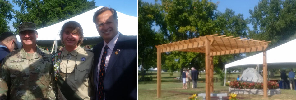
On September 16, 2016, the Phyllis E. Galanti Arboretum was formally dedicated in a ceremony officiated by Medical Center Director Brandecker, with speeches from the head of engineering James Dudley, a key project partner, and Virginia Congressman David Brat. Paul Galanti personally thanked everyone for honoring the work of his wife Phyllis.
Today, the hospital is managing the arboretum and working on ways to include it as part of its therapy programs. People walk the trails and those patients who are in recovery walk, run and wheel around the pathways, which are also now lighted to extend the hours each day people can use them for exercise and enjoyment of the area, even in winter. This project provides a model for how partnerships, donations and volunteerism can come together to create a healing landscape for cities, as well as for those who have served our country with such self-sacrifice and dedication.
Those wishing to support the GIC’s work on this
and other projects can Donate today.

Project Reports:

GIC Press Release: Strategy Helps Create Healthy James River and Healthy Community. March 2012 (pdf)
Watershed Coalition Final Strategies:
• Upper Goodes Creek Watershed Coalition Final Strategies. September 2013
Revitalize the Southside Festival
• The Watershed Coalition held a Revitalize the Southside Festival on October 19, 2013. See photos here (pdf).
For further information on the project, contact:
Thanks to Our Funders and Partners!
![]()