Position: Finance and Operations Manager
Start Date: Listed May 2026 – Rolling applications — Position open until filled.
The nonprofit Green Infrastructure Center is seeking a Finance and Operations Manager to manage government grants and contracts, track expenditures, supervise accounting team and onboard staff.
About: Founded in 2006, the national, nonprofit Green Infrastructure Center Inc. (GIC) is a leading designer of landscape conservation planning and conserving nature for healthier communities. The GIC helps communities realize that nature is “green infrastructure” and shows them how to use natural solutions to address climate change, urban heat islands, public health, and increased social and economic equity. This position is located at GIC’s Headquarters office in Charlottesville, VA. The position requires in-person office work. The position is intended to be full-time, but can be reduced to part-time (30 hours a week) for the right person. For more about GIC’s work see: https://gicinc.org/
Position Overview: GIC employs more than 23 full-time and 15 part-time staff with offices in 4 states. GIC’s administrative department includes the executive director, the senior accountant, and accountant. The position requires managing government grants and contracts, managing cash flow, reviewing financial statements, overseeing the organization’s budget, and onboarding new hires and management of benefit programs.
Requirements
Company Administration:
- Advise the Executive Director on grant work priorities and perform administrative/supervisory functions relative to operational activities and accounting staff, scheduling staff performance reviews, onboarding new staff and ensuring compliance with federal grant requirements for employees.
- Ensure all corporate filings are submitted when required (federal registrations, state annual reports, property taxes, and other charitable registrations.)
- Lead development of the annual company budget.
- Present financial and management data to the board of directors.
Grants and Accounting:
- Work with program managers and accounting team to ensure timely completion of grant invoicing and reporting.
- Work with GIC accounting team to ensure sound cash flow management.
- Ensure payroll is ready for review and processing using Paychex portal.
- Assist with preparation of bids and proposals.
- Coordinate annual audit responses for contracted audit firm.
- Review, update and track company budget throughout the year.
Personal Skills:
- Effective time management and organizational skills; sometimes under strict time constraints. • Performing multiple tasks during the workday while maintaining accurate records and files.
- Tact, diplomacy, and resourcefulness in resolving problems and managing stressful situations. • Team management and tasking for optimal workflows.
- Maintenance of safeguards for sensitive and confidential information and follow professional, ethical practices.
- Maintain a sense of humor and a collaborative attitude.
Work Environment and Demands: Ability to lift up to 10 lbs. occasionally and/or negligible weights frequently. Must be able to remain in stationary position more than 50% of the time. Constantly operate a computer and other office productivity machinery, such as a calculator, copy machine, and printer. Occasionally moves about inside the office to access file cabinets and office machinery. Office located one block from Charlottesville’s lively downtown mall. Space is fully accessible to all physical abilities.
Degrees and Experience: College degree required. Majors in accounting or business administration preferred. Must have a minimum of 5 years of experience managing federal and state grants and working at a senior management level. Must be willing to have a criminal background check.
Required Knowledge:
- Budgeting and grant management and grant reporting
- Nonprofit accounting and billing practices.
- Federal grant requirements within the Code of Federal Regulations.
- Basic accounting competency and familiarity with financial statements and organizational budgeting.
- Computer Software Skills: High proficiency with MS Excel. Must be literate in MS office suite (Excel, Word, PowerPoint) and able to use Intuit Quick Books online.
Compensation: Salary Range: $90,000 to $95,000 based on experience. This is a full time 40 hour week; salaried position. However, part time applicants for 30 hours per week will also be considered if applicant has the right skills and experience. Working less than full time will require a commensurate decrease in compensation and benefits. Full-time position benefits include paid leave for six federal holidays plus accrued leave @16 hours per month, and immediate enrollment in the company’s Anthem Health Plan, as well as dental and vision coverage. GIC’s retirement plan is offered after the first year of employment. This position follows state labor laws. This position is intended to be permanent, subject to maintaining company structure at current level. GIC is an equal opportunity employer and strongly encourages applications from diverse social, ethnic, and racial backgrounds as well as veterans who served in the U.S. military.
Supervisor: This position reports to the GIC’s Executive Director.
Job Location: Work location is at GIC’s headquarters in Charlottesville VA. Employee must reside in Virginia within a maximum one-hour commute to GIC’s Charlottesville Office to allow for in-office work. Hours are flexible but must be worked within normal business hours. GIC is an equal opportunity employer and does not discriminate.
Interested applications should submit their 1) cover letter, 2) resume with work experience, and three professional references to: Incomplete applications will be discarded. No calls please. GIC will not participate with job brokers. Applicant must be the direct point of contact.
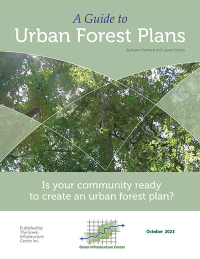
 Learn how to plan for and plant trees across cities using the right data, partnerships and budgets. Features case studies from across the southern U.S. and compelling arguments for funding urban forests. This guide provides the arguments for analyzing tree canopy coverage locations, tree condition and strategies for a community-wide strategic approach to tree conservation. Even if you — the reader — are an experienced arborist or forester, you may need better or different arguments to move a city council or county board to take action for tree planting or retention. Tree care professionals may not know how to obtain citywide data on tree coverage, while data managers may not understand how to engage field staff in reviewing and applying data to on-the-ground decision making. This guide bridges those gaps so that agencies, departments, tree care groups, tree professionals and elected officials can work better together to get the right data and make more informed decisions for our urban forests.